
Southington ZIP Code Labels
Connecticut's Secretary of the State postal-place list and USPS station information identify four ZIP labels serving Southington's named sections. The labels are Marion, Milldale, Plantsville, and Southington. They are delivery clues. They are not a claim that a ZIP polygon follows a town line, school district, voting district, parcel edge, or neighborhood border.
| ZIP Code | Areas or postal label | Post office | Notes |
|---|---|---|---|
| 06444 | Marion | Marion Post Office, 2321 Meriden-Waterbury Turnpike, (860) 621-0707 Monday-Friday 9:00-5:00, Saturday 9:00-noon | Verify each street and unit by address. |
| 06467 | Milldale | Milldale Post Office, 223 Clark Street, (860) 628-7800 Monday-Friday 9:00-noon and 2:00-4:30, Saturday 9:00-noon | Village postal label, not a municipal boundary. |
| 06479 | Plantsville | Plantsville Post Office, 847 South Main Street, (860) 628-6517 Monday-Friday 8:30-5:00, Saturday 8:00-noon | Use USPS for a border street or unit. |
| 06489 | Southington | Southington Post Office, 125 Main Street, (860) 628-4766 Monday-Friday 8:00-5:00, Saturday 9:00-noon | Central or general Southington postal label. |
The four rows create a helpful normalization set for a Southington ZIP code directory. They do not supply a complete border-street list. USPS by-address lookup controls an individual deliverable address, especially when a unit, ZIP+4, or older village name changes the result.
The Connecticut postal-place list is the source behind the place labels. Its role is to identify postal names, not to replace the Town Assessor, GIS, Engineering, registrars, or Town Clerk when a legal jurisdiction matters.
Southington Postal Stations
Each station is a practical fallback when a delivery label is unclear. The Marion station is on Meriden-Waterbury Turnpike. Milldale's station is on Clark Street. Plantsville's is on South Main Street, and Southington's is on Main Street. A counter can clarify a postal question, but it cannot certify who owns or occupies an address.
Keep the station name in historical notes. A directory may say Marion, Milldale, Plantsville, or Southington before a researcher knows the five-digit code. A modern USPS result may append ZIP+4, while an old source may use only a village or street. Retain the original wording and the normalized deliverable address as two separate fields.
Address first. A postal label can sort a clue, but only the full street address and unit should drive the next search. Do not turn a post-office label into a resident roster.
USPS Southington ZIP Search
The official USPS tool has three modes: By Address, By City and State, and Cities by ZIP Code. By Address is the strongest choice for a person or parcel question because it accepts the deliverable street and optional unit. City and State is useful for checking a postal place label. Cities by ZIP Code works from a five-digit ZIP and returns associated city names.
| Company | Optional text in By Address mode. |
|---|---|
| Street Address | Required in By Address mode; include the unit when one exists. |
| Apt, Suite, Other | Optional unit field in By Address mode. |
| City | Required in City and State mode; try the postal label shown by the source. |
| State | Required in City and State mode; select CT. |
| Five-digit ZIP | Required in Cities by ZIP Code mode; use five digits. |
| Find | Runs the selected lookup mode. |
| Mode tabs | By Address, By City and State, and Cities by ZIP Code. |
The USPS ZIP lookup warns that a result does not prove a person or company at an address and that a unit may be needed. That warning is central to a responsible ZIP code directory. A returned city name is a delivery-place result, not an occupancy finding.
The USPS lookup image shows the three search paths. Use the address mode first when the goal is to normalize a street, then save the exact returned label before moving to a local record search.
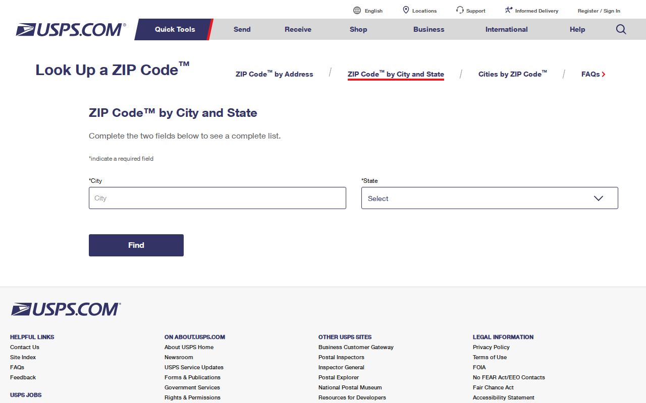
After the result, preserve both the typed address and the USPS response. A unit can change the postal result without changing the parcel's legal description.
Find a Southington ZIP
A ZIP-keyed search should narrow an address, not pretend to return every person in that postal area. The local systems accept different identifiers. Run the steps in order and keep a note of what each result actually confirms.
- Run USPS By Address with the full street and unit. If the source gives only a village, test Marion, Milldale, Plantsville, and Southington in City and State mode.
- Carry the normalized street into Vision. Vision has Address, Owner, Account, MBLU, PID, and All modes, but no documented ZIP search field. MBLU means map, lot, and unit; PID means parcel identifier.
- Save the Vision PID or MBLU, then use the Tighe & Bond GIS viewer for geographic context.
- Use GEMs by name, parcel or list, or street number and street name. The tax search has no documented ZIP mode.
- Use Civil Inquiry property-address search only for a court-address question. Its full ZIP field is optional and does not make a court result a resident list.
- Once the ZIP narrows the street, continue with the Southington street directory for address-keyed work.
City Squared also uses street number and street name for the town's permit and property lookup. It is not a ZIP search. The CT Big List has conditional City and ZIP fields, but it searches unclaimed property, not residents or parcels.
Southington ZIP Filters
The Tighe & Bond public GIS includes a Planning Zoning Zip Codes layer, but its metadata dates differ and the viewer does not promise a ZIP-wide export or current boundary authority. Turn the layer on for orientation, then check the parcel and address with the custodian that owns the question.
Vision has no ZIP field, GEMs has no documented ZIP mode, and City Squared is keyed to street number and name. Civil Inquiry property-address search accepts City or Town, Street Address, optional ZIP, Property Type, Status, and case filters. Its ZIP field narrows court records at an address, not the people who receive mail there.
The Connecticut Big List image below illustrates a different kind of ZIP-capable form. Its dynamic application can show name and conditional City, ZIP, or property-ID fields, but a result is a state-held asset claim lead. It cannot be used as a Southington resident directory.
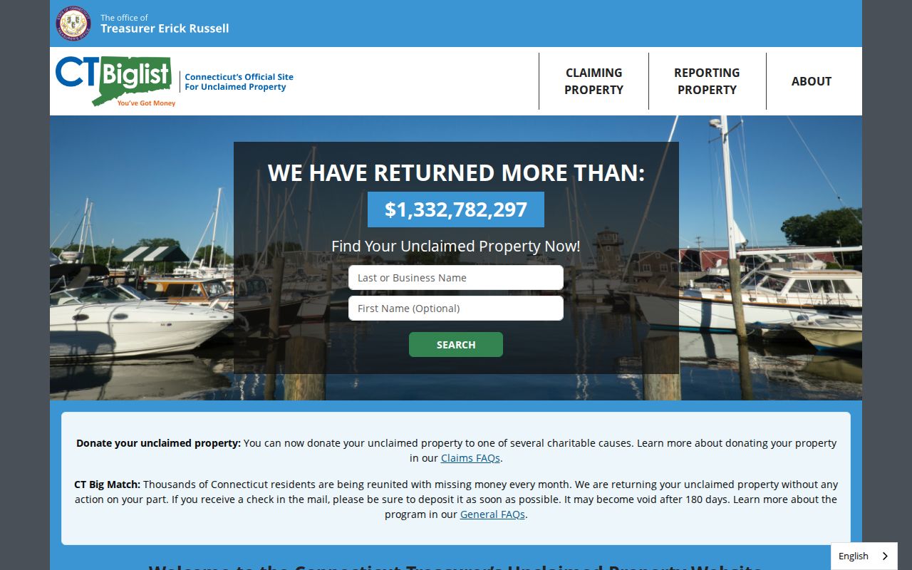
Keep the search purpose beside the ZIP. Postal validation, tax records, parcel maps, court addresses, and unclaimed property all use different record relationships.
Southington Village Labels
Southington's place history explains why older records can resist a modern postal search. The Plan of Conservation and Development describes Marion as a crossroads settled around 1739, Milldale as a south-central area tied to early industry, and Plantsville as a village center. Southington center is another common label in current and historical material.
A city directory or newspaper may use a village name without a five-digit ZIP. A map may show a street in a different way than a postal result. The safest bridge is to copy the old label, identify the street or cross street, and ask the library, Town Clerk, Assessor, GIS, or USPS to clarify the modern form.
This geography is useful for family history and local orientation. It is not evidence that every address using a village label shares one municipal border or one record custodian.
Southington Postal Address Logic
Four address ideas often sit beside one another. USPS controls the deliverable mailing form. Vision reports tax-record owner, mailing, and situs fields. GIS shows parcel geometry and layers. The Town Clerk's land record may use a subdivision lot or metes-and-bounds legal description. A registrar may use a district assignment. These systems can describe one place without sharing one search box.
- Five-digit ZIP
- A postal routing label used by USPS for delivery-place results.
- ZIP+4
- An added four-digit delivery detail that can distinguish a segment or unit; it does not create a parcel or resident record.
- Mailing address
- The address used to send a bill or notice, which may differ from the property's situs address.
- Situs address
- The location label tied to the property or parcel, not automatically a list of occupants.
- Carrier route
- A delivery route concept used by postal operations; it is not a town neighborhood roster.
When an old source does not match a current ZIP, keep the legal description, parcel ID, village, cross street, and USPS result together. Do not erase the old form. The mismatch may be the clue that leads to the right map or shelf.
Southington ZIP Boundaries
Postal boundaries and municipal boundaries do not have to coincide. A Southington mailing label can reflect delivery practice, while town records follow legal jurisdiction and parcel geometry. The research located no official public postal polygon, complete border-street list, or verified Southington postal split or realignment date. Avoid filling that gap with a guessed line.
The GIS Zip Codes layer is useful visual context, but differing metadata dates mean that a displayed shape needs confirmation. For a legal or records question, ask the Town Assessor, GIS or Engineering staff, registrars, Town Clerk, or USPS station which system controls the needed fact. A defined boundary-map or address-assignment request can also go to the town, although no public ZIP-boundary FOIA packet was located.
The Secretary of the State postal-place list image below is a reference for the four names, not a border survey. It helps preserve the distinction between Marion, Milldale, Plantsville, and Southington as postal labels.
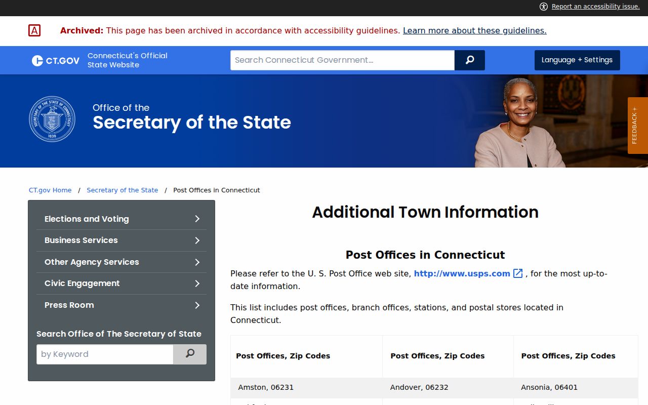
Use the state list with USPS by-address verification when a street or unit sits near a suspected change. The result still needs to be paired with the local record system that owns the question.
Southington ZIP Fallbacks
Online tools are the first channel, not the only one. A complete ZIP code directory workflow uses postal staff, town offices, library history, and written requests when a boundary or old address cannot be resolved on screen.
- Use USPS by-address, by-city-and-state, and cities-by-ZIP modes, then save the returned postal label and any ZIP+4.
- Call or visit the USPS station if delivery labeling is unclear. For parcel jurisdiction, ask the Town Assessor, GIS or Engineering staff; for a legal description, ask the Town Clerk.
- Ask Southington registrars about district assignment, and ask the library about historic postal labels, directories, newspapers, census, maps, and Sanborn material.
- Send a focused email, mail request, or Connecticut Freedom of Information request for a defined boundary map or address-assignment record. Name the date range and custodian.
The historical bridge matters when a family record predates postal codes. Directory front matter, Sanborn maps, newspapers, census snapshots, and town maps can show a village or street label without establishing a modern postal line. Preserve both eras rather than rewriting the older source.
A Southington ZIP code directory is most reliable when it stays modest: USPS verifies the deliverable address, local systems answer parcel or civic questions, and the record keeper confirms anything that could affect a person's rights or a property's legal description.